Mogget's Map
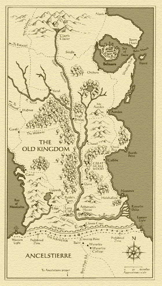
Mogget's Map is a geographical representation of the Old Kingdom, created by Mogget for Sabriel in the first book of the series by dipping a claw into ink and drawing on paper. It shows the whole breadth of the South of the country, but extends only a little further North than Clayr's Glacier, to the town of Navis. To the South, it extends past the Wall to Wyverley College.
In Goldenhand, we learn the Old Kingdom actually stretches further north until the Greenwash River, which marks the boundary of the realm. See Goldenhand Map.
See also[]
- Maps
- Locations
- Old Kingdom Locations
- Ancelstierre Locations
- Northern Locations